After Sydney and I had left the trail, Sydney continued to be quite motivated about hiking locally in the Seattle area. Three weeks later, in late September, she decided to drive two hours north of Seattle and go for a hike in the Northern Cascades. It was a Saturday morning and two miles into her hike she slipped and fell and broke her fibula just above her ankle. Of course, at the time, she didn’t know that she had broken anything – she just knew it hurt like hell!
As she tells the story, it took about thirty minutes to adjust to the pain and to gain her composure. She considered activating the S.O.S. button on her GPS device but didn’t. Luckily, as she hobbled her way back to the trailhead, a family came along and helped her out. Then she managed to drive the two hours back to Seattle. Somewhere along the way she called Donna and I and let us know about her accident.
Right before our PCT hike Sydney had just completed her Masters program at the University of Washington. Her new job was to start two days after her accident – her medical benefits wouldn’t start for thirty days after that. As a student she didn’t have good medical insurance so it took her a few days for her to figure out the system. Luckily she did have medical coverage. Surgery was recommended so Donna flew up to help with the initial recovery.
Right after surgery
The surgeon repaired her fractured bone by placing a plate to stabilize the fracture. It was anchored by nine screws!
Three weeks after the surgery, Donna and I were back in Seattle for her follow-up appointment. This is a photo of her ankle at that time.
We spent almost a week together as she continued her recovery. Beau was there for moral support.
It’s been almost six months since Sydney had her accident. She is doing fine but is still recovering. I think she is worried that she won’t recover completely. I think she will. Time will tell. I’m hoping that she’ll be able to complete those last eighty miles.
Sydney and I arrived in Stehekin yesterday – typically the final town and resupply stop before completing the trail. We were eighty trail miles from the Northern Terminus of the PCT, which is right on the Canadian Border. In a normal non-pandemic year most PCT hikers get a Canadian entry permit and walk into Canada. It’s an additional eight mile walk to Manning Park where hikers can enjoy all the typical town amenities and then catch a bus to Vancouver. The last two years, however, the border has been closed to hikers (due to Covid). Several months ago Canada had opened its formal entry points like airports and highways where visitors could be vetted. But, despite our hope, Canada had not extended legal entry to hikers. ☹️
In 2020 and 2021 PCT hikers who reach the Northern Terminus have to turn around and hike back into the United States at least thirty miles to Harts Pass (a trailhead) or fifty miles to Rainy Pass (on Highway 20). I was not very excited about having to turn around but had not eliminated that possibility.
To make matters worse, apparently I said something to Sydney last night after dinner that upset her, so we were a little out-of-sorts. ☹️☹️☹️
As we considered our options, and tried to repair our relationship, we took the free shuttle back to the pastry shop for breakfast. The pastry shop is famous for their cinnamon rolls. We saw one hiker buying six cinnamon roles to take back on the trail for the last few days hike to Canada.
I had an egg and sausage sandwich along with my coffee. It was pretty yummy!
Also since Oregon I had been dealing with a chronic muscle spasm under my left scapula. It has something to do with hiking and carrying my backpack. I had been dealing with it with daily stretching and Vitamin I (Ibuprofen). But it had been getting worse.
Stehekin
The more I thought about it, the more I liked the idea of hiking the last eighty miles with Donna. Now that she had recovered from her two knee replacements, she is certainly capable of getting back on the trail for a relatively short hike. It seemed fitting to complete the trail with the original four feet that started at the Mexican border. And I would really like the experience of hiking into Canada. So that’s what I decided. I don’t think Sydney was very happy with me but hopefully she will be able to join us and we can all complete the trail together.
So we bought tickets for the ferry from Stehekin to Chelan.
Stehekin from the FerryGood Bye Stehekin!
Blake and Tahnee and our little grandkids (as opposed to our big grandkids) were there at Chelan when we got off the ferry. They drove up from Boise. Tahnee’s father Greg was there also – he had helped us last week at Stevens Pass and Leavenworth. It was great to see them all.
An earlier photo
So that’s how the hike ended. It was a little disappointing to not finish after getting so close. But I look forward to returning with Donna and Sydney and completing this damn trail together. Hopefully Canada will open the border and we can finish during the summer of 2022. Stay tuned. And thanks for following.
Sydney and I were up early this morning. We had twenty miles to hike by 3pm. The following photo was taken at 6:20am as we left our camp. As you can see, we were treated to a beautiful sunrise.
Our goal today was to get to the little town of Stehekin, on the shores of Lake Chelan – a 50-mile long skinny lake in northern Washington. It’s the largest lake in Washington. The PCT passes by north of the lake. There’s a shuttle that takes hikers from the PCT (at High Bridge) to the little town of Stehekin. Our shuttle was at 3pm. So we had eight-plus hours to hike the twenty miles. We were motivated by the thought of restaurant food, beer, showers, beer, etc.
Luckily for us, today’s walk through the woods was primarily downhill. Last night’s campsite was at an elevation of 5800 feet. We would finish our hike at 1600 feet – over 4000 feet lower! Here’s an elevation profile of today’s hike.
A few minutes after hitting the trail, we had a nice view looking down the valley in the direction we were headed.
About forty-five minutes later, we enjoyed another nice view down the valley.
The trail crossed through rock fields
through forests with dead trees
across small streams
and through areas overgrown with lush green vegetation
and then through more forests
As the day progressed we were constantly aware of how far we had hiked and what time it was and how much further we had to go. We entered Lake Chelan National Recreation Area at 1:30pm. We only had about two more miles – I think we’re going to make the shuttle!
We also entered North Cascades National Park.
We crossed over the Stehekin River at 2:10pm. We would be at the shuttle stop in five minutes.
Stehekin River
It’s about an eleven mile shuttle drive from the trail to Stehekin. On the outskirts of town is the Stehekin Pastry Company – probably the most famous bakery on the entire PCT!!! I have read about and heard about this bakery for many years. The shuttle makes a fifteen minute stop at the bakery before heading into town. I couldn’t pass up on the ice cream. Yum!!!
It was Thursday September 2, right before Labor Day weekend. All the cabins and hotel rooms were booked. ☹️ But there was a campground for PCT hikers to set up their tents. We could still have dinner in the restaurant overlooking the lake and we still had access to a shower. 😊
After we got into town, we picked up our resupply boxes that we had mailed to the post office. We took showers. We set up our tents in the campground. And then we headed to the restaurant for a nice dinner. It was a great evening!
The lake was beautiful as the daylight slowly disappeared and the night took hold.
After a cold, wet and rainy day yesterday Sydney and I woke up to sunshine and clear blue skies. Yay!!! We didn’t start hiking as early as normal – it took us a while to dry out our gear in the early morning sunshine.
There was not a cloud in the sky as I took this photo looking north from our campsite – it was about 8:30am.
Shortly after we started hiking we had a nice view back at Glacier Peak. We were finally on the north side of this large glaciated mountain. It took us four days to navigate around Glacier Peak, but they were some of the most memorable miles on the entire PCT.
Glacier Peak
Today the trail was full of downed trees. I had to navigate around a lot of fallen trees in northern Oregon about a month ago, but so far this hadn’t been much of a problem in Washington. Until today.
There were also some large trees along the trail that hadn’t fallen!
A little before 1pm we crossed over a large new footbridge that crossed over the Suiattle River. The trail had been detoured several years ago to cross over this large river at the new bridge after the previous old bridge had washed away. The detour was a long, narrow “U” shaped alternate trail that followed along the course of the river – up one side, over the bridge and the back down the other side. It added about six miles to our hike.
The new bridgeSuiattle River
It was still a pretty hike. And it wasn’t raining!
After paralleling the river for several miles, we crossed over this small bridge over Miners Creek, a small creek that drains into the Suiattle River. The old PCT had crossed over the larger river near here before the old bridge had failed.
For the next eight miles the trail made a slow and steady climb of three thousand feet. The trail was relatively new and was nicely graded so that the elevation gain didn’t seem too challenging. But it still took about three hours.
Late in the afternoon, as we neared the top of the climb, we crossed over a fifty yard obstacle course of blow downs, probably from an avalanche last winter.
After navigating the obstacle course we neared the top of our climb and were treated to some nice views.
The Plant of the Day is called Hard-skinned Puffballs (aka Earthballs). These are a type of fungi that take on a roughly spherical shape and are related to mushrooms. They may be toxic so do not eat.
We didn’t make camp until 7pm but it was a nice flat area and there was a stream nearby.
Shortly after we got into our tents last night it started raining. It rained all night. It was still raining at 6am – our usual “get up and get going”time. I told Sydney to stay in her tent for a while longer. I think we both fell back asleep. It was nice to sleep in.
I woke up again at 8am and it was still raining. My Garmin GPS device has weather report capability, so I checked the weather. There was something like an 80% chance of rain for the rest of the day.
There was an outdoor toilet nearby with a view – I took advantage of it and then returned to my tent to consider our options.
In my tent, I considered our situation. We were pretty isolated. We had packed food for five-plus days. Today was day four and we still had 50 miles to Stehekin. The original plan was to hike 20 miles today and tomorrow and then have an easy ten miles on our last day into Stehekin. I concluded that we couldn’t just sit here in our tents all day – we needed to hike at least ten miles today. It continued to rain. At 10am I told Sydney that we need to break down our camp and get back on the trail by 11am. So that’s what we did. At 11am we were back on the trail as it continued to rain.
It didn’t take long before we were soaked. As long as we kept moving we stayed relatively warm. The trail went downhill for the first few miles and then reversed and headed uphill for the next four or five.
We were mostly in the forest. It was wet and green and there was moss growing up the trees. It was obvious that rain is a normal part of the environment here.
After about eight miles the trail leveled out. We were at about 6000 feet elevation. It was cold. We were still soaked. It started to snow.
A little later, after we had hiked ten miles, we started to look for a campsite. There was one coming up but if it was occupied, we would have to continue hiking. Luckily it was empty, so we quickly set up our tents. After Sydney hopped in her tent, I collected water for both of us from a nearby stream. Soon we were both in our tents, in our dry camp clothes and in our dry sleeping bags trying to warm up. I think we both dozed off for a bit. But we warmed up. Eventually we made dinner and then retired for the night. I hope the weather is better tomorrow … we need to make some miles!
The weather changed during the night and we woke up to cooler temperatures and clouds on the horizon. We had camped at about 5600 feet just southwest of Glacier Peak and today we would spend the day traversing around the western flank of this large mountain. Here was our early morning view looking north shortly after getting back on the trail.
The trail would descend for the first five miles. Almost immediately we were back in the forest. There are a lot of streams and creeks that flow down from the glaciers on Glacier Peak. Today we would cross over quite a few. Sometimes we had a bridge like this one over the White Chuck River.
You can tell the rushing creek in the following video is melt-off from a glacier by the “silty” or “milky” color. This one drains from the White Chuck Glacier.
As we continued down the trail we experienced a typical forest trail – smooth, compacted dirt – nice to walk on!
The footbridge over Baekos Creek had failed and was broken in half but it was still passable.
As we continued down the trail there were more bridges crossings.
We were walking through a cloud as we approached the bottom of our five mile descent.
When we arrived at Kennedy Creek there was a large log over the creek. The creek was rushing along pretty strong. The choice was to walk across the log or to scoot across it on your bums. We decided to scoot across the log on our bums. A slip here would not have been good! I went first and then recorded Sydney as she “inched” her way across.
At the bottom of our descent, the elevation was about 3700 feet. We would then go uphill for the next five miles. We mostly climbed through the forest in damp and foggy conditions.
We continued to hike and stopped to have lunch after 2pm
Lunch Time
After our short break for lunch we continued northward around the western side of Glacier Peak. It was still cloudy and overcast.
Later in the afternoon we stopped and watched the marmots as the they stopped and watched us. I don’t know who was more curious???
We never experienced any rain today but it did stay cool and damp and either foggy or overcast all day.
Late in the afternoon we crossed over the top of Fire Creek Pass at an elevation of 6311 feet. We enjoyed the views and took some photos.
Here’s a view looking back at Glacier Peak from Fire Creek Pass. We were now northwest of the peak.
More views from Fire Creek Pass
Late in the afternoon we hiked through this rock field as we approached Mica Lake
Mica Lake is a beautiful glacial lake right along the PCT and makes for very scenic photos. There were a few campsites but they looked exposed and the weather was foreboding enough that Sydney and I decided to continue on to a more protected campsite.
Mica LakeMica Lake
The trail descended from Mica Lake and we soon found a more protected campsite. There was a stream close by so this seemed like a good place to spend the night.
There was a family of Grouse living nearby – a mother Grouse and her chicks – this is a photo of the Mama Grouse as she supervised her chicks feeding on the grass near our tents.
Sydney and I had a good night in our group campsite above Pear Lake. We were up at 6am and back on the trail before 7am. We weren’t the first ones to leave. Before we left I snapped this photo of the lake.
Pear Lake
A few minutes later, after we were back on the trail, we had a view north towards Glacier Peak. That’s where we are headed today. As you can see, it was another beautiful morning on the PCT in northern Washington. Sydney and I would spend the day slowly hiking towards the western flank of this glaciated isolated mountain in the northern Cascades. I didn’t know it yet but today would be one of the most beautiful and spectacular days on the entire PCT!
Glacier Peak
An hour into our hike, when we were up on an exposed ridge, I looked behind us – to the south – and enjoyed a great view of the snow-capped top of Mt. Rainer. It’s been about eight hiking days since we passed through Mt. Rainer National Park but today the Park’s namesake mountain didn’t look very far away.
Mt. Rainer
The trail was good and alternated between the forest, wide open green meadows and exposed ridge tops.
As we hiked along through the forest I took a photo of a large mushroom adjacent to the trail. This is the Plant of the Day. It’s a King Bolete Mushroom, aka Porcini Mushroom. These are common forest mushrooms that generally grow around the roots of forest trees. They are usually edible but they can cause allergies so it’s best not to collect or consume them while camping in the wilderness.
King Bolete Mushroom
Every time we popped out of the forest we had wonderful views of nearby and distant mountains and valleys. It was incredibly clear.
Late in the morning, it looked like there were small forest fires to the east. Where is Smokey-the-Bear when you need him?
Around 12:30pm we stopped and had lunch next to Lake Sally Ann, a small but very picturesque lake right along the PCT.
Lake Sally AnnLake Sally AnnLake Sally Ann
As soon as we left Lake Sally Ann we saw a plume of smoke from another apparently larger fire in the distance to the northeast.
A little later we had great views of the jagged peaks of the Northern Cascades. These peaks were to the northwest of us – the PCT will stay to the east (i.e. to the right) of these mountains.
North Cascades
In another mile or two we were treated to more views of Glacier Peak – we’re getting closer!
And then more views behind us to the south. We hiked by those jagged peaks in the past week. Did you notice Mt. Rainer on the right?
A few minutes later, as the trail took a short jaunt to the east, we had beautiful views of this lush green valley that contained the headwaters of the Little Wenatchee River
The trail turned back to the north and we enjoyed more views of Glacier Peak as we hiked across these amazing alpine meadows.
A couple miles later, as we continued north towards Glacier Peak, a large forested valley appeared to the left of the trail running off to the northwest. The headwaters of the North Fork Sauk River were hidden in the bottom of the valley.
A few steps later we passed the 2500 mile marker – only 152 more miles to Canada!
We collected some water from a small stream along the trail.
Soon we had another spectacular view of another valley to the east of the trail.
Late in the afternoon we had another view of Glacier Peak – it finally looks like we are getting closer!
We spent miles hiking through these alpine meadows – here’s Sydney as she tries to keep up with the “wicked” pace that her old man is setting!
As we hiked along the trail through these exposed meadows we marveled at the incredible views of the surrounding mountains and valleys. We watched numerous marmots foraging on the meadow’s grasses and shrubs. These are called Hoary Marmots. They typically live in colonies above the tree line. Sydney and I have seen them often when we’ve been above tree line – they are always entertaining to watch.
Hoary Marmot
Or sometimes spying on us from their dens
We also saw quite a few Sooty Grouse foraging on the ground
Sooty Grouse
And then we had another view back at the distant Mt. Rainer towering above the rest of the landscape.
At 6pm we passed over Red Pass at 6634 feet. The trail turned to the east and dropped down into this beautiful valley where we would look for a campsite.
We were now just southwest of Glacier Peak and had fantastic views of the mountain as the sun got lower and the trail became engulfed in the early evening shade.
We didn’t make camp until 7pm. It was a nice campsite and there was a stream nearby. I think we’ll sleep well tonight.
As I mentioned in my last post, Sydney and I enjoyed our zero day yesterday in the small “Bavarian-themed” town of Leavenworth. Greg picked us up this morning at 6:30am and drove us back to Stevens Pass where we had left the trail two days ago. It was about a thirty minute drive. Thank you Greg!
Me, Sydney & Greg
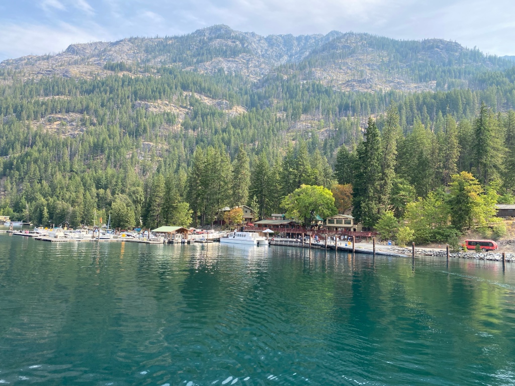
We were on the trail and hiking by 7:30am. Our packs were loaded up with five-plus days of food – approximately ten pounds heavier than when we left the trail two days ago. The next town stop is the tiny town of Stehekin on the shore of Lake Chelan, a narrow fifty-mile long lake in northern Washington. For most northbound PCT hikers, Stehekin is the last town stop and resupply opportunity before reaching the northern terminus monument at the Canadian border.
It was a little chilly this morning but the skies were blue – it was going to be a nice day. The trail was flat and well groomed for the first couple of miles which made for an easy start with our heavy packs.
We soon entered the Henry Jackson Wilderness.
The trail started to climb and in a couple of hours we passed Lake Valhalla, a very pretty lake that is popular with weekend day hikers. There was a trailhead nearby and today was Saturday so there were quite a few day hikers on the trail enjoying their weekend hike.
Lake Valhalla
In another couple hours we passed Lake Janus – the day hikers had disappeared.
Lake Janus
Early in the afternoon we had our first view of Glacier Peak (10,525’) – a volcano and the fourth highest peak in Washington. Apparently it has erupted five times in the past three thousand years which makes it one of the most active volcanos in the Cascade Range. Little did we know at the time, but the next four days would be spent hiking around the west and then northern sides of this large mountain.
Glacier Peak
We passed by beautiful mountain meadows.
and then passed over the top of Grizzly Peak (5597’) – not really much of a peak compared to some of the other Cascade mountains.
Grizzly Peak in the foreground
As we continued hiking we enjoyed distant views of the northern Cascade peaks and wondered if these particularly jagged peaks were in our future.
Panoramic view to the north with Glacier Peak on the right
Late in the afternoon we reached Pear Lake and decided to make camp. There was a large campsite in the trees just above the lake that would accommodate five or six tents, a not uncommon occurrence on the PCT. When we arrived there was already another tent set up but the hikers were no where to be seen. Then I figured out they were in the lake swimming – I believe there were three guys out for the weekend. Shortly after we arrived another PCT hiker arrived and set up his tent. After the three campers finished swimming they came up to the campsite. We all said hello but they gave us a funny look. I think they felt like this was their private campsite and that we were invading it. On the PCT, however, it’s customary that you only get to stake a claim on the actual ground your tent is on. In popular campsites, particularly when there are no other campsites available, it’s not unusual for another PCT hiker to set up their tent right next to yours. After we explained PCT etiquette and that additional PCT hikers were likely to arrive, the three weekend hikers decided to move on to another more private campsite. A little while later a couple more PCT hikers arrived and set up their tents for the night.
Pear Lake
Today was a beautiful day on the trail with perfect weather. We hiked nineteen miles with about forty-six hundred feet elevation gain in fully loaded packs. We should sleep well tonight!
Leavenworth is a cute little Bavarian-themed town on the east side of the Washington Cascades. After Greg picked us up yesterday, we drove into town, had lunch together and then Sydney and I checked into our hotel .
Leavenworth
The rest of the afternoon was spent doing laundry, taking showers and organizing our food resupply that we had picked up at Stevens Pass. Greg gave us a nice bottle of wine. Of course we enjoyed it with a large pizza for dinner. Thanks Greg!
What a treat!
Our zero day was quite leisurely. It was nice not to have to get up at the crack of dawn. We had breakfast across the street at a restaurant Greg recommended. The Leavenworth business district is not that large and is very touristy so we strolled through town and checked out the sights. Sydney had been here before but this was my first visit. We stopped at the local gear shop and picked a few small items. By then it was lunchtime – a stop at the local craft brewery for lunch and hydration was a requirement. Later in the afternoon we visited the local grocery store for a few food items that we had not mailed – things like flour tortillas, snicker bars, cookies, chips. A very typical zero day. Zero days also give me an opportunity to post some blogs on the hike which require Wi-Fi – usually I’m seven to ten days behind.
The next morning Greg picked us up at 6:30am and drove us back to Stevens Pass. Thanks Greg!
After two perfect-weather days with nothing but clear blue skies, Sydney and I woke up to a cloudy, chilly and gloomy morning. But we knew we only had ten miles to Stevens Pass where we would be picked up by Tahnee’s (my daughter-in-law) father (Greg) at noon. So our spirits were high as we looked forward to seeing Greg and spending the night in town.
We didn’t start hiking quite as early as most days but we still left camp by 7am.
Town days typically include restaurant food, showers, laundry, usually a good nights sleep in a hotel room and sometimes a zero day. Oh, I almost forgot, there’s also usually a beer or two to be consumed. So today, as we hiked along the trail anticipating all the upcoming town delights, our packs felt a little lighter and our pace a little quicker.
The truth is, however, that our packs were as light as they ever get. The food that we started out with at the last town had mostly been consumed. Trail food weighs almost two pounds per day. Depending on the number of days in between town resupplies, our packs typically are six to ten pounds lighter on the last day before resupplying. So our packs actually were lighter and hopefully our steps a little quicker!
It’s not often we hikers have a toilet opportunity in the wilderness, but today we did – Hallelujah!!!
After about an hour of hiking we passed another beautiful Cascade lake – Hope Lake
Hope Lake
and then, fifteen minutes later, Mig Lake – another pretty little lake.
Mig Lake
It remained overcast all morning – typical Washington weather per Sydney – but the scenery was still beautiful and inspiring.
All morning long, the plants and bushes along the trail were wet from a light drizzle. As I hiked along, my pants couldn’t help getting wet as they brushed up against these saturated plants. Along the trail were these bright red berries from a plant called Sitka Mountain-Ash – note all the moisture on the leaves.
Sitka Mountain-Ash
As we got closer to Stevens Pass, we began to see evidence of civilization and crossed under power lines.
Soon we passed under the Stevens Pass ski lifts – we must be getting close!
Then the trail crested near the ski lift station and we made the final descent down to Stevens Pass
Late in the morning we arrived at Stevens Pass. Greg was there waiting for us. It was 11:45am. I had told Greg four days ago that we would be there close to noon. He was amazed that we could hike the seventy-one miles from Snoqualmie Pass to Stevens Pass and time it so well. Thanks Greg!!!
Stevens Pass
If you zoom in the photo above, you may see Greg waiting by the side of the main building as Sydney approaches. Sydney definitely “smelled the barn” – that was about as far ahead of me that she ever got in the entire state of Washington!
It was great to see Greg and we were so thankful that he took the time to come retrieve us. He is now an official Trail Angel!
Sydney and I had mailed our resupply boxes directly to the lodge at Stevens Pass so we picked up our boxes and then hopped in Greg’s truck and he drove us down to Leavenworth. We all had lunch together and then Sydney and I checked into our hotel – we would be there two nights and take a zero day tomorrow.